Skip to the content of the web site.

Ask us: via chat, in person, email or phone

Maps • Geospatial Centre • Air Photos Digitization Project

Waterloo : 1930 and 2006


Digital Historical Air Photos of Wellesley Township

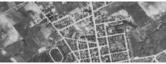
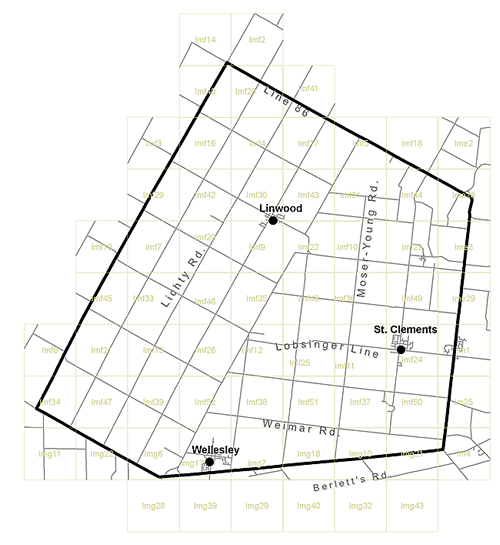
This index represents the full coverage of digital aerial photography available for viewing and downloading.  Each image is bounded by the tile represented above and is linked from this index.  If more than one year is available for the tile, it will appear on the corresponding webpage.  Please click on your area of interest to view image information and to access the photos. 1930 mosaics have also been created for the towns of Wellesley and St. Clements. 

Wellesley Index IMG43 IMG32 IMG40 IMG29 IMG39 IMG28 IM4 IMG21 IMG10 IMG18 IMG7 IMG17 IMG6 IMG22 IMG11 IM25 IMF50 IMF37 IMF51 IMF38 IMF52 IMF39 IMF47 IMF34 IM1 IMF24 IMF11 IMF25 IMF12 IMF26 IMF13 IMF21 IMF8 IMF49 IMF36 IMF48 IMF35 IMF46 IMF33 IMF45 IME3 IMF23 IMF10 IMF22 IMF9 IMF20 IMF7 IMF19 IME28 IMF44 IMF31 IMF43 IMF30 IMF42 IME2 IMF18 IMF5 IMF17 IMF4 IMF16 IMF3 IMF28 IMF40 IMF2 IMF14


Please email any questions, comments or suggestions to :

Eva Dodsworth, Geospatial Data Services Librarian

Air Photo Digitization Banner

University Map Library, 2008

, Geospatial Data Services Librarian, Geospatial Centre
February 11, 2009