
![]()
![]()
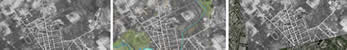
Feel free to download the following Shapefiles to overlay with your georeferenced imagery.
File |
Data Source |
Title |
| Roads | Natural Resources Canada | NTDB (National Topographic Database) |
| Vegetation | Natural Resources Canada | NTDB (National Topographic Database) |
| Water | Natural Resources Canada | NTDB (National Topographic Database) |
All of the geospatial files are in UTM projection, NAD83 and cover the Region of Waterloo.
University Map Library, 2008